
Site Description
The Strait of Juan de Fuca is located in the northwest corner of Washington State along the U.S./Canadian border. The Strait is a deep water body connecting the Pacific Ocean and the inland waters of Washington State. It is generally divided into two subregions: the outer strait – west of Ediz Hook – and the inner strait.
Open to read more
The outer strait supports significant populations of groundfish, clams, shrimp, sea urchins, and Dungeness crab, as well as other fisheries resources. The inner strait is also very productive and species-rich area, supporting large populations of birds, mammals, fish, and shellfish. It is one of the major habitats for marine birds on the Pacific coast of North America. Local economies are based primarily on natural resource use and tourism.
Refer to Resources at Risk for more detailed natural resource information.
Physical Features
The two subregions of the Strait of Juan de Fuca may include the following shoreline habitats:
- Exposed rocky headlands
- Wave-cut platforms
- Pocket beaches along exposed rocky shores
- Sand beaches
- Sand and gravel beaches
- Sand and cobble beaches
- Exposed tidal flats
- Sheltered rocky shores
- Sheltered tidal flats
- Sheltered marshes
Open to read more
Two important features within the inner strait are Ediz Hook and Dungeness Spit. They are accreted gravel spits which protect embayments. The bay inside of Ediz Hook has been dominated by commercial activity from the Port Angeles harbor. Dungeness Spit and Bay are located inside a national wildlife refuge. Activities there include oyster-farming and recreation. The extensive tideflats in this area support a diverse body of marine organisms and shorebirds.
Hydrology
The Strait of Juan de Fuca is characterized hydrographically as a two-layer system. The upper 30 meter layer is relatively fresh water and the lower layer more saline. The Strait receives a large freshwater influx from the Fraser River and Puget Sound drainages. The two periods of high freshwater runoff occur during spring now melt and late fall and winter.
Climate and Winds
Tidal ranges average between four and ten feet producing strong tidal currents. Currents in the Strait may reach two to four knots, depending on tidal range and prevailing winds. North and west-facing shorelines along the Strait are subject to the largest waves and are high energy areas.
Open to read more
The Strait of Juan de Fuca is affected by strong winds, most notably from the west. These winds occur when high pressure is pushing strongly behind the passage of a cold front from the west. The westerlies often reach gale force.
A strong east wind is possible when an Arctic cold front pushes south from interior British Columbia into Western Washington. These conditions may contribute to strong easterlies at certain times of year. These winds may also reach gale force.
Tides and Currents
Tidal ranges average between four and ten feet producing strong tidal currents. Currents in the Strait may reach two to four knots, depending on tidal range and prevailing winds. North and west-facing shorelines along the Strait are subject to the largest waves and are high energy areas.
Resources at Risk
This chapter provides a summary of natural, cultural, and economic resources at risk in the Strait of Juan de Fuca. It provides general information on habitat, fish, and wildlife resources, and locations in the area where sensitive natural resource concerns have been identified. It offers a summary of cultural resources that include fundamental procedures for the discovery of cultural artifacts and human skeletal remains. General information about flight restrictions, wildlife deterrence, and oiled wildlife can be found near the end of this section. A list of economic resources in the area is provided in the appendix.
Open to read more
This chapter is purposely broad in scope and should not be considered comprehensive. Some of the sensitive resources described in this chapter cannot be addressed in Chapter 4 (Response Strategies and Priorities) because it is not possible to conduct effective response activities in these locations. Additional information from private organizations or federal, state, tribal, and local government agencies should also be sought during spills.
This material is presented with enough detail to give general information about the area during the first phase of a spill response. During an actual incident, more information about resources at risk will be available from the Environmental Unit within the Planning Section.
Note: specific resource concerns related to areas that already have designated protection strategies may be found in the “Resources Protected” column of the matrix describing the individual strategies.
The information provided in this chapter can be used in:
- Assisting the Environmental Unit (EU) and Operations Sections in developing additional (ad hoc) response strategies beyond those already in the plan.
- Providing resource at risk “context” to responders, clean-up workers, and others during the initial phase of a spill response in the GRP area.
- Briefing responders and incident command staff that may be unfamiliar with sensitive resource concerns in the GRP area.
- Providing background information for personnel involved in media presentations and public outreach during a spill incident.
- Providing information on benthic and water column species or cultural resources present to assist in planning for oils with the potential to sink or submerge.
Natural Resources at Risk – Summary
This area contains a wide variety of aquatic, riparian, and upland habitats. These habitats support many of Washington’s anadromous salmonid species as well as a complex diversity of other wildlife including mammals, birds, and amphibians. Due to their life histories and/or behaviors, some of these species are unlikely to be directly oiled during a spill incident but may be disturbed by other operations such as cleanup, reconnaissance, or fire suppression activities. Some of the bird species are resident throughout the year, but many others seasonally migrate outside the basin.
Open to read more
A number of the species found in this area are classified as threatened or endangered under the Federal Endangered Species Act or Washington State guidelines.
Classification types are:
- Federal Endangered (FE)
- Federal Threatened (FT)
- Federal Candidate (FC)
- State Endangered (SE)
- State Threatened (ST)
- State Sensitive (SS)
Federal and State Threatened and Endangered species that may occur within this area, at some time of year, include:
Birds:
- common loon [SS]
- marbled murrelet [FT/SE]
- northern spotted owl [FT/SE]
- Oregon vesper sparrow [SE]
- sandhill crane [SE]
- short-tailed albatross [FE]
- tufted puffin [SE]
Mammals:
- blue whale [FE/SE]
- fin whale [FE/SE]
- fisher [SE]
- gray whale (western North Pacific) [FE/SS]
- humpback whale (Central America) [FE/SE]
- humpback whale (Mexico) [FT/SE]
- killer whale (southern resident) [FE/SE]
- right whale (north Pacific) [FE/SE]
- sea otter [ST]
- sei whale [FE/SE]
- sperm whale [FE/SE]
Fish:
- bocaccio rockfish [FE]
- bull trout [FT]
- chum salmon (Hood Canal, summer) [FT]
- chinook salmon (Puget Sound) [FT]
- green sturgeon [FT]
- steelhead (Puget Sound) [FT]
- yelloweye rockfish [FT]
Shellfish:
- pinto abalone [SE]
Insects:
- monarch butterfly [FC], Taylor’s checkerspot butterfly [FE/SE]
Critical Habitats
Critical habitats are the specific areas occupied by an endangered or threatened species that contain the physical or biological features that are essential to the conservation of that species – and that may need special management or protection. Critical habitat may also include areas that were not occupied by the species at the time of listing but are essential to its conservation.
Critical Habitats for the following species have been federally designated within this area:
- bocaccio rockfish
- bull trout
- Chinook salmon (Puget Sound)
- chum salmon (Hood Canal, summer)
- green sturgeon
- humpback whale (Central American population)
- humpback whale (Mexican population)
- killer whale (southern resident)
- marbled murrelet
- northern spotted owl
- steelhead (Puget Sound)
- Taylor’s checkerspot butterfly
- yelloweye rockfish
General Resource Concerns
Habitats:
Open to read more
- Intertidal and shallow subtidal mud/sand flats occur in bays throughout the region and at the mouth of the Pysht River. These habitats are rich in benthic and epibenthic organisms, creating important foraging areas for salmon, crabs, fishes, and shorebirds.
- Sandy/Rocky shorelines can be found throughout the region. These areas support marine mammal haulout and pupping, nesting for gulls, guillemots, and oystercatchers, and spawning habitat for forage fish.
- Extensive areas of eelgrass in Dungeness, Sequim and Discovery Bays serve as important nursery and foraging areas for crab, salmonids, other fishes, and waterfowl.
- The kelp beds present in nearshore areas along much of this region’s shoreline serve as important fish rearing areas. These habitats provide critical nursery areas for juvenile rockfish and other fish and shellfish as well as important spawning habitat for herring and feeding areas for waterfowl.
- Salt marsh habitat areas scattered throughout this region support a diverse array of birds, insect and fish and wildlife species. Channels through salt marsh serve as nursery areas for salmonids and crabs, and as roosting areas and foraging habitat for shorebirds and waterfowl.
- Most rivers and streams flowing into the strait provide spawning and rearing habitat for a diverse array of salmonid species and amphibians. The associated riparian scrub and woodlands play a crucial role in supporting a large diversity and abundance of songbird species as breeding, migrating, and overwintering habitat.
- The open waters of the strait are important migration corridors for many species of fish, birds and marine mammals.
- Offshore rocks and islands support several of Washington’s largest seabird colonies and serve as important as marine mammal haulout areas.
- A variety of subtidal habitats exists within this area, each of which supports a different assemblage of wildlife species as generally described below:
- Soft sediments, such as clay, mud, sand, and gravel. These areas are broad flat and relatively level. Animals that tend to live on the surface of these habitats may include sea cucumber, sea stars, crustaceans (such as crab and shrimp), and bottom fish such as skate, cod, and the flat fishes.
These soft sediment habitats also support shellfish and other invertebrates including copepods (a major food source for salmonids, forage fish and shorebirds), bivalves, worms, brittle stars, and shrimplike crustaceans. The burrowing or foraging activities of these animals may penetrate up to one meter below the subsurface bottom.
- Soft sediments, such as clay, mud, sand, and gravel. These areas are broad flat and relatively level. Animals that tend to live on the surface of these habitats may include sea cucumber, sea stars, crustaceans (such as crab and shrimp), and bottom fish such as skate, cod, and the flat fishes.
-
- Rock reefs serve as important habitat for a wide range of species including mobile invertebrates (e.g. snails, sea slugs, sea cucumbers, sea stars, etc.) and immobile species (e.g. anemones, barnacles, shellfish, sponges, tubeworms, etc.). Macro algae and kelps also widely utilize the structure that this type of habitat provides. The crevices and overhangs associated with these reefs serve as valuable habitat for a wide variety of other species such as crabs, shrimp, octopus, wolf eel, rockfish, and lingcod. If located within their capabilities to dive, these areas may also serve as important foraging areas for birds and marine mammals.
- Non-hard rock walls are composed of steep consolidated glacial deposits. These structures function much like rock reefs but with a more permeable surface due to animal activity and geological processes that erode out small boulders leaving temporary pockets in the surface of the structure. The plant and animal life in these habitats is similar to that described for rock reefs except that long-lived immobile life forms (i.e. sea anemones) may be less abundant due to the sloughing of the wall surfaces.
- Boulder and cobble fields. Larger, relatively stable boulders provide many of the same ecological functions described for rock reefs while the interstitial spaces under the sides and between boulders offer enhanced spaces for refuge of bottom dwelling invertebrates and fish. The relative instability of the smaller cobbles makes them less valuable to immobile marine life, although many marine organisms may still live on, or between, the cobblestones. These areas may also serve as important foraging areas for other species of fish and crustaceans. As with the rocky reefs, these habitats may also serve as important foraging areas for birds and marine mammals as well, if these areas are located within these species capacity to dive. Depending on the typical pattern of currents in the area, the spaces between the rocks may fill with soft sediments that can also support bottom dwelling life forms.
- Water column. Due to light penetration and nutrient availability, much of the primary marine productivity in this region occurs in the upper 30 meters of the water column. In addition to the presence of planktonic algae, this part of the water column is populated with the larval phases of fish and a wide range of invertebrates – particularly during the spring plankton blooms. The water column serves as habitat for wide-ranging fish such as salmon, forage fish (herring, smelt, sandlance), sharks, etc., as well as a wide variety of birds and marine mammals.
Fish and Shellfish:
- Adult salmonids of all species are seasonally present during their migrations to spawning grounds in the strait or elsewhere in Washington waters. Major salmon runs occur in both the Elwha and Dungeness Rivers, with additional spawning in up to 50 other smaller streams and rivers. The Elwha and Dungeness Rivers and Morse Creek also support runs of bull trout.
- Forage fish spawning occurs throughout the region. Herring spawning is associated with eelgrass habitats in Kilisut Harbor, Dungeness, Sequim and Discovery Bays. Sandlance and surf smelt spawning is associated with sand and gravel beaches throughout the strait.
- The intertidal and shallow subtidal areas in Dungeness, Sequim and Discovery Bays and off the south shore of Protection Island provide critical habitat for Dungeness crabs.
- Hardshell clams are found throughout the eastern half of the strait, primarily in the large, shallow bays from Port Angeles, eastward.
- Shrimp, abalone, geoducks and sea urchins are found throughout the region, with some locations supporting commercial or tribal fisheries.
Wildlife:
- Protection, Tatoosh, Smith, and Minor Islands are among the state’s most important seabird nesting colonies. Other, smaller, seabird breeding sites are scattered throughout the strait.
- Nearly the entire breeding population of common murres in coastal Washington and northern Oregon moves through the strait in late summer, following the nesting season. Many of these birds remain to overwinter in the strait until the spring.
- Black oystercatchers are residents throughout the area with increasing abundance during the winter months due to an influx of birds from Alaska and British Columbia. Large groups of nonbreeding oystercatchers can regularly be found at Smith and Minor islands, and Tongue Point.
- Large numbers of waterfowl and shorebirds use the eastern bays of the strait for migratory staging or wintering areas.
- Numerous bald eagles nest along shorelines throughout the strait.
- Harbor seal haulouts and pupping areas occur throughout the entire strait, with major concentrations occurring at Dungeness Spit, Protection Island, and Smith and Minor Islands. Elephant seals haulout and pup on Protection, Smith and Minor islands. The single Steller sea lion haulout at Tatoosh Island supports relatively low numbers of non-breeding animals, however individuals or small groups of Steller sea lions haul out throughout the area in winter.
- A few sea otters may be found year-round near Tatoosh Island, and small numbers occasionally winter in the strait as far east as Pillar Point.
- The nearshore waters of this region support small numbers of gray whales, both spring migrants and summer “residents”, with the latter occurring predominantly in the western half of the strait. Humpback whales (including Mexican and Central American populations) are also becoming more common throughout the area.
- While rare, deep-water species of whale such as the blue, fin, and sperm whales may potentially be present with the straits.
- Killer whales (southern resident, transient and/or offshore populations) are potentially present in the area at any time of the year.
- Dall’s porpoise and harbor porpoise are common throughout the strait.
Specific Geographic Areas of Concern – Overview
Eastern Section (see Figure 1)
Open to read more
- Smith and Minor Islands: Offshore rocks and islands, kelp, and sandy/rocky shoreline habitats. Federally threatened Puget Sound chinook critical habitat. Seabird, waterfowl, and shorebird concentration area. Second largest seabird nesting colony in Washington’s interior waters and supports eagle and oystercatcher nesting. Marine mammal haulout and pupping area. USFWS National Wildlife Refuge.
- Crockett Lake/Keystone Harbor (Whidbey Island): Wetland and eelgrass habitats. Forage fish spawning. Federally threatened Puget Sound chinook critical habitat. Waterfowl and shorebird concentration area. Federally threatened golden paintbrush and federally endangered Taylor’s checkerspot butterfly at Ebey’s Landing. State Park. Public ferry.
- Discovery Bay: Wetlands, eelgrass, and floating kelp (mouth of bay) habitats. Salmonid spawning and rearing habitats. Federally threatened bull trout, Hood Canal summer-run chum, and Puget Sound chinook, along with designated critical habitats. Forage fish spawning habitat. Dungeness crab and shellfish. Waterfowl and shorebird concentrations (fall-spring). Heron and raptor nesting. Harbor seal haul outs. State Park.
- Protection Island: Offshore rocks and islands, eelgrass, and floating kelp. Federally threatened golden paintbrush. Shellfish and shrimp. Puget Sound chinook and Hood Canal summer-run chum designated critical habitat. Waterfowl, shorebird, and seabird concentrations. Largest seabird nesting colony in Washington’s interior waters. Oystercatcher and eagle nesting. Elephant and harbor seal haulout and pupping area. USFWS National Wildlife Refuge and WDFW Seabird Sanctuary.
- Sequim Bay: Wetlands, eelgrass, and floating kelp (outside of spit) habitats. Salmonid spawning and rearing habitats. Forage fish spawning. Federally threatened bull trout, Puget Sound steelhead, Hood Canal summer-run chum, and Puget Sound chinook, with designated critical habitats. Shellfish and shrimp. Waterfowl and shorebird concentrations. Raptor nesting. Marbled murrelet presence and designated critical habitat.
- Dungeness Spit/Jamestown area: Intertidal and shallow subtidal mud/sand flats, salt marsh, eelgrass, floating kelp and riverine habitats. Dungeness River mouth and associated salt marsh habitat. Federally listed bull trout, Hood Canal summer-run chum, and Puget Sound chinook, with designated critical habitats. Waterfowl, shorebird, seabird, and raptor concentration area. Salmonid spawning and rearing habitats. Forage fish spawning. Dungeness crab and shellfish. Steller sea lion, elephant and harbor seal haulout; harbor seal pupping area. Federally endangered Taylor’s checker spot butterfly presence. USFWS National Wildlife Refuge.

Figure 1 – Eastern Part of GRP
Central Section (see Figure 2)
- Port Angeles: Wetland, eelgrass, and floating kelp (outside of spit) habitats. Concentrations of waterfowl, shorebirds, seabirds, and common loons. Small numbers of nesting seabirds. Salmonid spawning and rearing habitat. Forage fish spawning habitat. Federally threatened bull trout, Puget Sound steelhead and Puget Sound chinook, with designated critical habitats. Dungeness crab and shellfish. Small harbor seal haulouts on log booms/rafts. Numerous public parks and beaches.
- Freshwater Bay: Wetlands, eelgrass, floating kelp and riverine habitats. Salmonid spawning and rearing habitats. Forage fish spawning. Federally threatened bull trout, Puget Sound steelhead, and Puget Sound chinook, with designated critical habitat. Dungeness crab and shellfish. Waterfowl and common loon concentrations. Marbled murrelet presence. Raptor nesting. Tribal lands and resources.
- Crescent Bay: Marine wetlands, salt marsh, eelgrass, and floating kelp habitats. Salmonid spawning and rearing habitats. Federally threatened bull trout and designated critical habitat. Dungeness crab and shellfish. Common loon concentration. Marine mammal haul outs. Gray whale presence. Salt Creek Recreation Area.

Figure 2 – Central Part of GRP
Western Section (see Figure 3)
- Pysht River Estuary: Wetlands, saltmarsh, intertidal mudflats, and floating kelp. Salmonid spawning and rearing habitat. Forage fish spawning. Federally threatened bull trout and designated critical habitat. Dungeness crab and shellfish. Waterfowl and shorebird concentrations (fall-spring). Marbled murrelet breeding.
- Clallam Bay: Wetlands and floating kelp. Salmonid spawning and rearing habitat. Forage fish spawning. Dungeness crab and shellfish. Marine mammal haul out.
- Hoko River: Wetlands and intertidal habitats. Floating kelp. Salmonid spawning and rearing habitats. Urchin and shellfish. Intermittent sea otter presence. Tribal lands and resources.
- Neah Bay and vicinity (including Seal and Sail Rocks): Wetlands and intertidal habitats. Floating kelp. Seabird concentration and nesting colony. Salmonid spawning and rearing habitats. Dungeness crab, urchins, and shellfish. Marine mammal haul out. Intermittent sea otter presence. Tribal lands and resources.
- Tatoosh Island: Marine wetlands. Floating kelp. Seabird concentration and nesting colonies (3rd largest in WA). Shorebird concentration. Marine mammal haulout. Intermittent sea otter presence. Tribal lands and resources.
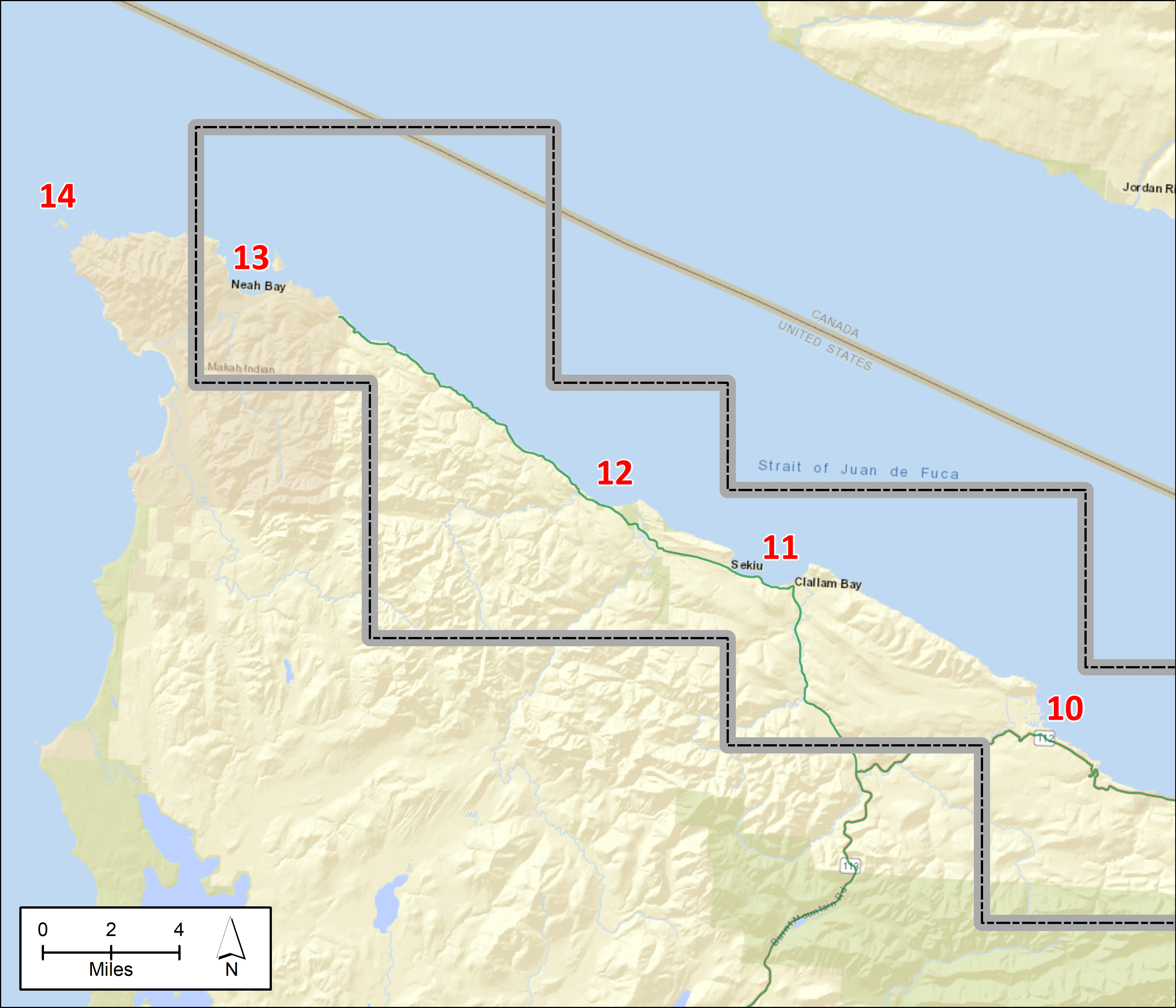
Figure 3 – Western Part of GRP
Cultural Resources at Risk – Summary
Culturally significant resources are present within the planning area. Information regarding the type and location of cultural resources is maintained by the Washington Department of Archeology and Historic Preservation (WDAHP). This sensitive information is made available to the Washington Department of Ecology for oil spill preparedness and response planning. The Tribal Historic Preservation Offices (THPOs) or Cultural Resource Departments of local tribes (see table below) may also be able to provide information on cultural resources at risk in the area and should be contacted, along with WDAHP, through normal trustee notification processes when significant oil spills, or smaller spills above reportable thresholds, occur in the area.
Open to read more
During a spill response, after the Unified Command is established, information related to specific archeological concerns will be coordinated through the Environmental Unit. In order to ensure that tactical response strategies do not inadvertently harm culturally sensitive sites, WDAHP should be consulted before disturbing any soil or sediment during a response action, including submerged soils or sediments. WDAHP and/or the Tribal governments may assign a person, or provide a list of professional archeologists that can be contracted, to monitor response activities and cleanup operations for the protection of cultural resources at risk. Due to the sensitive nature of such information, details regarding the location and type of cultural resources present are not included in this document.
In addition to the listed Tribes and Nations, there may be additional Tribes with “Usual and Accustomed” fishing and hunting rights, including Canadian First Nations. Please consult the Tribal Coordinator or Liaison Officer within Unified Command for more information. WDAHP’s tribal consultation tools, including an area of interest map, may help identify additional tribal (US) government contacts during a spill (https://dahp.wa.gov/archaeology/tribal-consultation-information).
| Contact | Phone | |
| Washington Department of Archaeology and Historic Preservation | (360) 586-3080 | Rob.Whitlam@dahp.wa.gov |
| Jamestown S’Klallam Tribe | (360) 681-4638 | dbrownell@jamestowntribe.org |
| Lower Elwha Klallam Tribe | (360) 460-1617 | bill.white@elwha.nsn.us |
| Lummi Nation, THPO | (360) 312-2257 (360) 961-7752 |
lenat@lummi-nsn.gov |
| Makah Nation, THPO | (360) 645-2711 | makahthpo@gmail.com |
| Muckleshoot Tribe, Archaeologist | (253) 876-3272 | laura.murphy@muckleshoot.nsn.us |
| Port Gamble S’Klallam Tribe | (360) 297-6359 | marieh@pgst.nsn.us |
| Puyallup Tribe of Indians | (253) 573-7986 | brandon.reynon@puyalluptribe.com |
| Samish Nation, THPO | (360) 726-3399 | jferry@samishtribe.nsn.us |
| Sauk-Suiattle | (360) 436 0131 | thpo@sauk-suiattle.com |
| Skokomish Indian Tribe, THPO | (360) 426-4232 x2015 | shlanay1@skokomish.org |
| Snoqualmie Tribe | (425) 495-6097 | steve@snoqualmietribe.us |
| Stillaguamish Tribe of Indians | (360) 652-3687 x14 | KLyste@stillaguamish.com |
| Suquamish Tribe, THPO | (360) 394-8529 | dlewarch@suquamish.nsn.us |
| Swinomish Indian Tribal Community, THPO | (360) 466-7352 | lcampbell@swinomish.nsn.us |
| Tulalip Tribes | (425) 239-0182 | ryoung@tulaliptribes-nsn.gov |
| Upper Skagit Tribe | (360) 854-7009 | sschuyler@upperskagit.com |
Economic Resources at Risk – Summary
Socio-economic sensitive resources are facilities or locations that rely on a body of water to be economically viable. Because of their location, they could be severely impacted if an oil spill were to occur. Economically sensitive resources are separated into three categories: critical infrastructure, water dependent commercial areas, and water dependent recreation areas. A future additional appendix will provide a list of economic resources for this GRP area.
Fish hatcheries and infrastructure
| Facility | Managed by | Waterbody | Latitude | Longitude | Address | Phone |
| Dungeness | WDFW | Dungeness River | 48.0283 | -123.1402 | 1261 Fish Hatchery Rd Sequim, WA 98382 |
360-683-4255 |
| Elwha Channel | WDFW | Elwha River | 48.1149 | -123.5516 | 326 Crown Z Water Rd Pt. Angeles, WA 98362 |
360-457-2959 |
| Hurd Creek | WDFW | Hurd Creek | 48.1199 | -123.1430 | 955 Fasola Rd Sequim, WA 98382 |
360-683-1738 |
| Morse Creek Rearing Pond | WDFW | Morse Creek | 48.1044 | -123.3568 | W Hwy 101 Pt. Angeles, WA 98362 |
360-457-2959 |
| House of Salmon | Lower Elwha Klallam Tribe | Elwha River | 48.13369 | -123.549 | 700 Stratton Road, Pt Angeles, WA 98363 | 360-565-7270 |
General Information
Wildlife Refuges and Wilderness Areas
The following federal wildlife refuges exist within this region: San Juan Island National Wildlife Refuge; Protection Island national Wildlife Refuge, and Dungeness Spit National Wildlife Refuge.
Open to read more
Aquatic Invasive Species
The waters of this region may contain aquatic invasive species (AIS) – species of plants and/or animals that are not native to an area and that can be harmful to an area’s ecosystem. If so, preventative actions may be required to prevent the spread of these species as a result of spill response activities and the Environmental Unit is able to recommend operational techniques and strategies to assist with this issue.
Flight restriction zones
The Environmental Unit (Planning Section) may recommend Flight Restriction Zones to minimize disturbance or injury to wildlife during an oil spill. Pilots or operators can decrease the risk of aircraft to bird collisions, prevent the accidental driving of wildlife into oiled areas, and minimize abandonment of nests by keeping a safe distance and altitude from these identified sensitive areas.
The Air Operations Branch (Operations Section) will manage all aircraft operations related to a response and will coordinate the establishment of any Flight Restriction Zones as appropriate. Environmental Unit staff will work with the Air Operations Branch Director to resolve any conflicts that arise between flight activities and sensitive resources.
In addition to restrictions associated with wildlife, Tribal authorities may also request notification when overflights are likely to affect culturally sensitive areas within reservations. See Oil Spill Best Management Practices (NWACP Section 9301) for more information on the use of aircraft and helicopters in open water and shoreline responses.
Wildlife Deterrence
The Wildlife Deterrence Unit within the Wildlife Branch (Operations Section) manages wildlife deterrence operations. These are actions intended to minimize injuries to wildlife by keeping animals away from the oil and cleanup operations. Deterrence activities may include acoustic or visual deterrent devices, boats, aircraft or other tools. The Wildlife Branch works with state and federal agencies, and the Environmental Unit (Planning Section), to develop deterrence plans as appropriate.
For more information see the Northwest Wildlife Response Plan (NWACP Section 9310) and Northwest Area Wildlife Deterrence Resources (NWACP Section 9311).
Oiled Wildlife
Capturing oiled wildlife may be hazardous to both personnel and the affected animals. Incident personnel should not try to approach or capture oiled wildlife but should report any observations of oiled wildlife to the Wildlife Branch (Operations Section). For more information see the Northwest Wildlife Response Plan (NWACP Section 9310).